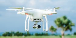
Roof Inspection Takes Flight
The task of inspecting and measuring roofs can be time-consuming and dangerous. To avoid this, you can use drones to do the work for you and improve the accuracy and safety of the roof inspection process.
DroneDeploy, a drone mapping software platform provider, offers the opportunity to stay off the roof with its 3D Flight App, which generates PDF roof reports and DXF files from imagery taken via drones.
“Using a DJI drone, the software enables any single estimator, surveyor or contractor to go out to a commercial property to measure a roof extremely accurately without the need to get up on the roof, tie in and use measuring tape,” says Nicolas Guerra-Mondragon, Business Development Director at DroneDeploy. “It eliminates safety risk issues, and you don’t need to spend over an hour measuring the roof.”
The app allows users to plan and initiate the flight on their phone, and the drone will capture the roof autonomously. When it lands, users can upload the data to the cloud-based platform where DroneDeploy processes the data and runs it through its algorithm to detect edges, mounting planes and obstructions. It then creates a highly accurate model of the roof.
“Facilities managers are often just making sure their buildings are operating as designed – to make sure there aren’t any leaks, cracks or issues on the roof,” explains Guerra-Mondragon. “Instead of having to go up on the roof for inspection, you can capture everything and get imagery that you can inspect from your office.”
Users can contract a drone operator to get the imagery. For those with an in-house survey team, DroneDeploy can collaborate on projects.
For more information, watch its roof report video at https://youtu.be/Sf8LpjHx5NA
