AerialPoint
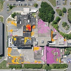
AerialPoint is an interactive, web-based software tool that analyzes aerial infrared data. Users can forecast and prioritize spending by categorizing problem severity, intensity, and amount of area affected.
The software can track the effectiveness of maintenance activities and categorize repair actions by portfolio, property, or section of property. It also displays an itemized detail of a repair, its cost, who performed it, and any associated warranty information.
