How Aerial Imagery Technology is Enabling the Construction of 15-Minute Cities
Imagine a city where every amenity—work, school, markets and recreation—is just a brief walk or cycle away. This is the vision of the 15-minute city, an urban planning concept that aims to improve residents’ quality of life by providing them easy access to work, school, food, healthcare and recreation, while reducing greenhouse gas emissions caused by transportation. Originally catalyzed by the COVID-19 pandemic—and now, amid an obesity pandemic, loneliness pandemic and the climate crisis—the backdrop of such a city isn't just a nostalgic dream, but a future within our grasp. And the bridge between this vision and reality? Aerial imagery and location intelligence technology.
This innovative tool equips urban developers and building owners with detailed, cost-effective site surveys, 3D modeling and crucial location intelligence to make cities where people can work, play and live—all within a 15-minute radius—a reality. It's a game-changer in developing self-sufficient neighborhoods and a cornerstone in the quest for greener, connected, smart cities that help improve quality of life. And as we delve into the practicalities of aerial imagery, let's explore how it turns the compelling concept of the 15-minute city into a tangible future.
Aerial Imagery Brings the Vision to Life
Expanding access to aerial imagery and location intelligence technology allows developers to survey sites while saving money on individual flyovers. 3D models generated from high-resolution aerial imagery are a fast and affordable way to provide a detailed view of any location for superior site selection.
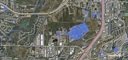
Aerial imagery can serve as the foundation for maps that empower planners to gain a contextual view of the location. Images can be overlaid with map data that depict flood zones, fault lines and other environmental factors that might pose challenges to the construction of bicycle lanes, green spaces and other sustainable infrastructure. Detailed maps and models can be easily shared with stakeholders, reducing the frequency of on-site visits.
Once business owners arrive in the 15-minute city, they too can benefit from location intelligence built upon aerial imagery. For example, foot traffic patterns can inform decisions on staffing, resource allocations and energy use patterns. In these ways, convenient access to comprehensive data and insights can contribute to informed decisions and shorten project timelines and expenses.
Powered by The Sun, Enabled by Aerial Imagery
The 15-minute city’s environmental value lies not only in its potential to mitigate the impact of transportation, but also to embrace solar energy. Aerial imagery helps developers identify the infrastructure most suitable for solar panel installation. They can pinpoint sources of shade and pivot panel positioning for peak sunlight exposure. Building-integrated photovoltaics (bIPV) materials can be used to create roof tiles, siding and windows that convert sunlight into the building’s energy source.
Developers working on a 15-minute city do not have to completely rebuild an old city to enable benefit from solar power. BIPV features can be retrofitted or added post-construction, and developers can use 3D models generated from aerial imagery to tailor bIPV systems to a building’s shape, positioning and energy needs for optimal performance.
Future 15-minute cities’ skylines might not look much different than the city skylines of today. Thanks to aerial imagery, skyscrapers can be outfitted with aesthetically pleasing, solar-powered facades that elevate them to self-sufficient structures.
And walking paths can be illuminated by solar-powered streetlamps that help municipalities avoid the trenching, wiring and labor costs associated with connecting streetlamps to the main grid. Aerial imagery can help developers determine which paths would benefit most, and help them optimize panel positioning for optimum performance.
Taking Steps Toward Walkable Cities
The 15-minute city might be having its 15 minutes of fame, but the benefits–more opportunities for physical activity, a greater sense of community, a reduction in greenhouse gas emissions–will ripple through generations of Americans. In combination, aerial imagery and location intelligence equip cities to construct sustainable infrastructure that drives health and economic well-being.
About the Author

Shelly Carroll
Shelly Carroll is the Vice President and General Manager, Public Sector of Nearmap. She has served the geospatial profession for over 25 years in both the public and private sector.

